Large winter storm system dumps rain on Northeast, snow in other parts of East
A large winter storm that brought blizzard conditions to the Midwest was hitting much of the East Coast on Christmas Eve, bringing snow to parts of the South and rain to the Northeast.
The combination of heavy rain and existing melting snow from last week’s storm could lead to flooding from the mid-Atlantic to New England. Winter weather advisories are extended as far south as northern Georgia, Kentucky and Tennessee.
New York City and the surrounding areas could now see wind gusts up to 70 mph and 2 to 4 inches of rain through Friday morning, according to an updated forecast from the National Weather Service.
A coastal flood advisory includes the entire south shore of Long Island, coastal Connecticut, Westchester and areas surrounding New York Harbor, according to weather service.
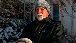
Parts of Pennsylvania had received up to 2 inches of rain as of Thursday evening.
“Anyone dreaming of a white Christmas will have to settle for a windy and soggy holiday,” New York City Emergency Management Commissioner Deanne Criswell said. “However, the hazards are real, and we want every New Yorker to prepare for the potentially damaging winds and heavy rain.”
But there was snowfall elsewhere in the East and South.
Knoxville, Tennessee, had received 2 inches by early evening while Beverly, Kentucky, notched 4 inches. Londonderry, Ohio, received 3 inches.
Winter storm warnings were in effect for Minnesota’s Twin Cities, with 6-8 inches of snow expected and near whiteout conditions. On Thursday, Minneapolis will see wind gusts up to 25 mph and a high of 6, which is 40 degrees lower than their high Wednesday of 46.
“Winds could gust as high as 60 mph, causing significantly reduced visibilities in blowing snow,” according to the National Weather Service.
A spokesman for the Minnesota State Patrol said in a tweet that troopers have responded to hundreds of crashes, spun-out and stalled vehicles, as well as 11 jackknifed semitrailers, just between 4 and 9 p.m. on Wednesday.
Minnesota Gov. Tim Walz authorized the state’s National Guard to provide emergency relief services for motorists who are stranded in the winter storm, according to his office.
Rain expected up and down East Coast
On Christmas Eve, the storm will move east, producing a variety of weather and bringing falling temperatures to much of the Midwest. Very strong winds will accompany the storm, with wind warnings and advisories all the way from the Gulf Coast to the US-Canada border.
Winter storm watches extend as far south as Kentucky and Tennessee, with a winter mix of precipitation expected. Heavy snow is expected as lake effect snow becomes heavy in areas like Buffalo, New York.
Places as far south as the Tennessee Valley could wake up to snow on Christmas morning, including Chattanooga and Knoxville, Tennessee; Asheville, North Carolina; and the North Georgia mountains.
High temperatures will only climb into the 30s as far south as central Georgia on Thursday. These below average temperatures will linger across the eastern US through Saturday
As the storm moves east, it will be mainly a rainmaker. Christmas Eve was to be wet for millions from Upstate New York to the Florida Panhandle. There could even be some severe storms.
“This storm setup could easily allow for dangerous winds and even a few brief isolated tornadoes,” CNN meteorologist Gene Norman said. “Especially at risk on Christmas Eve are eastern sections of North and South Carolina, southern Georgia and Alabama, and parts of the Florida Panhandle.”
The Carolinas are under an enhanced risk for severe weather, which is at a level 3 of 5. About 4 million people live in this zone.
From the Ohio Valley down to the Tennessee Valley, rain will switch to snow Thursday afternoon. Much of West Virginia and Eastern Ohio could see 3-5 inches of snow, with higher elevations seeing even more.
Heavy rain following snow can also cause rapid melting and flooding. The National Weather Service’s office in Binghamton, New York, warned residents of the risk.
“Where recent heavy snow fell, this could add weight to old snowpack on roofs/structures resulting in collapsed structures,” the agency said.
The storm will clear out for most by morning, leaving a cold and windy Christmas across the South, but parts of the northeast will be rather warm.