LIVE updates: Tropical storm threatening Texas to Florida
HOUSTON, Texas -- With the potential of Tropical Depression Cristobal to bring heavy rain and strong winds to parts of Texas this weekend, Gov. Greg Abbott was briefed Friday afternoon on the storm's latest projections and the state's preparedness.
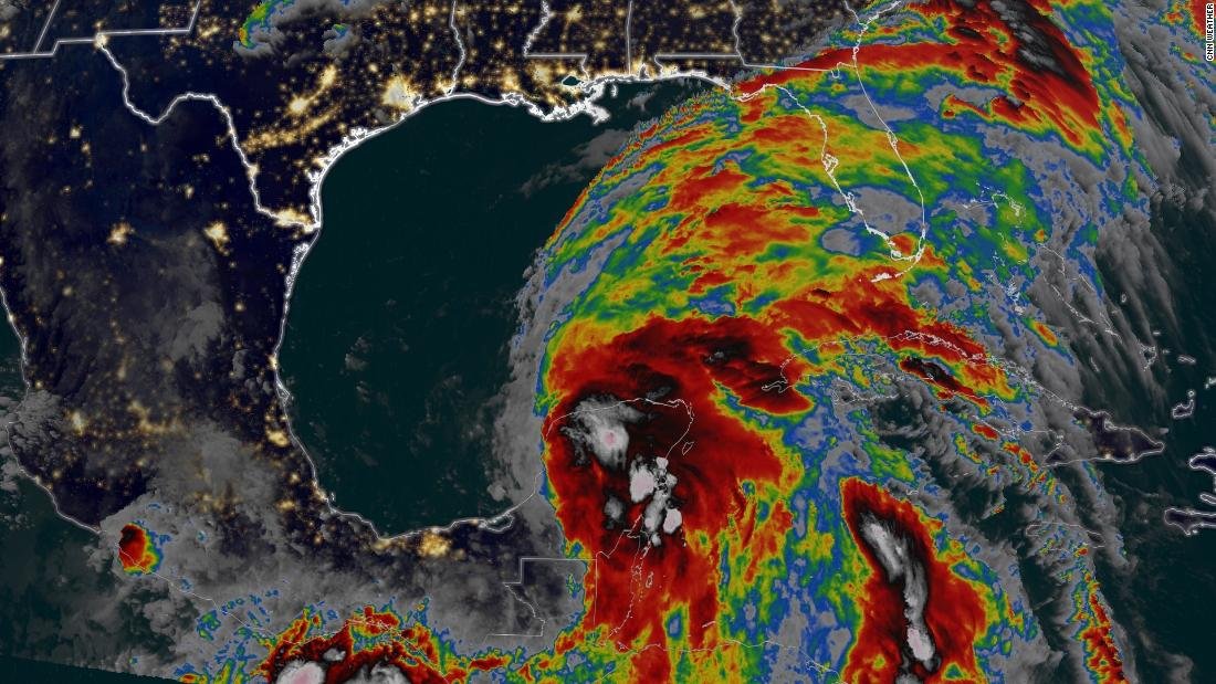
The Gulf Coast is on alert - storm and surge watches have been issued - as Cristobal is forecast to strengthen back into a tropical storm that could impact anywhere from East Texas to the Florida Panhandle.
The latest forecast track has the third named storm of this already active hurricane season moving ashore across the Gulf Coast as a tropical storm as soon as Sunday afternoon or night anywhere from Louisiana to the Florida Panhandle.
Tropical-storm-force winds are expected to reach the Gulf Coast between Texas and Florida as early as Saturday night, according to National Hurricane Center forecasts. The storm's strength and where it might hit are likely to become clearer by Saturday morning.
"The highest winds, greatest storm surge and heaviest rain may occur east of where Cristobal makes landfall, so not only is the Louisiana coast at risk but also Mississippi, Alabama and well into the Florida Panhandle," CNN meteorologist Dave Hennen said.
"It looks like flooding will be the greatest threat from the storm and could occur over a wide area from Texas to Florida," he added. "It could produce widespread heavy rain associated directly from the storm and from a lot of tropical moisture that is already funneling into places like Florida."
As of midday Friday, Cristobal had winds of 35 mph and gusts of 45 mph and was moving to the north at 12 mph as it began to move off Mexico's Yucatan Peninsula.
A tropical storm watch was issued for the northern Gulf of Mexico coast from Intracoastal City, Louisiana, to the Alabama-Florida border, including New Orleans, Lake Pontchartrain and Lake Maurepas.
A tropical storm watch means conditions including strong winds and heavy rainfall are possible within the watch area, generally within 48 hours, according to the National Hurricane Center.
A storm surge watch was issued for the northern Gulf of Mexico coast from Indian Pass to Aripeka, Florida, and from Grand Isle, Louisiana, to Ocean Springs, Mississippi, including Lake Borgne.
A storm surge watch means there is a possibility of life-threatening inundation from rising water moving inland from the coastline in the indicated locations during the next 48 hours.
