El Paso City Council briefed on virus hotspots, top places for exposure & infections
EL PASO, Texas -- El Paso City Council met for a work session Monday afternoon and into the evening with an agenda dominated by coronavirus-related items in the wake of record-setting active cases and hospitalizations that prompted a nightly curfew to be put in place.
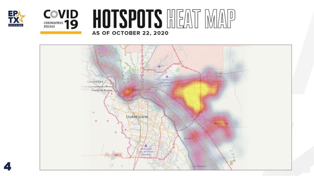
A heat map shown during one of the presentations at the meeting outlined so-called "hotspot" areas of the city for virus spread. It appeared the 79936 zip code was of particular concern. (See video above and map toward bottom of article.)
In addition, health officials also outlined a breakdown of places where virus exposures have been most prevalent, based on tracing among El Pasoans who have been infected. The results are as follows:
- Retail stores 37%
- Restaurants 22.5%
- Mexico travel 19%
- Parties & reunions 10%
- Gyms 7.5%
- Large gatherings 4%
The segment of the meeting on hotspots is available for viewing in the video player at the top of this page, while the entire meeting is viewable in the video player at the bottom of the article.


