Weather Alerts
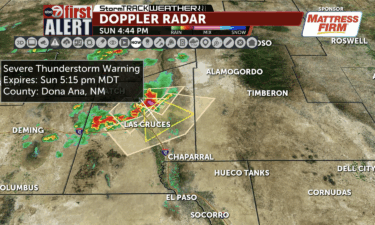
Severe Thunderstorm Warning for Las Cruces and University Park until 5:15 PM for 70 MPH winds
The National Weather Service has issued a Severe Thunderstorm Warning for Las Cruces and University Park until 5:15 PM for 70 MPH wind gusts and penny sized hail. This storm is located 6 miles west of Organ, moving southeast at 25 mph.
Continue Reading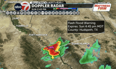
Flash Flood Warning issued for Central Hudspeth County along Interstate 10 until 4:45 PM
The National Weather Service has issued a Flash Flood Warning issued for Central Hudspeth County along Interstate 10 until 4:45 PM.
Continue Reading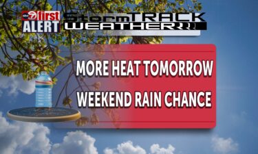
ABC-7 First Alert continues – Our third triple in a row. More to come.
El Paso hit day three of triple digit heat. 104 was the high for Wednesday. Another hot day is expected again for Thursday. We should hit 103 with some added clouds. As we bring in a little bit of moisture Friday and the weekend, temps will cool a little as the rain and storm chances
Continue Reading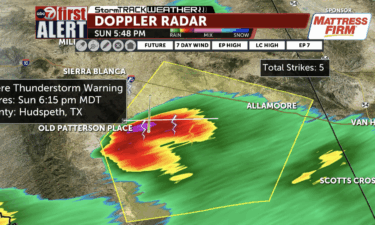
ABC-7 First Alert: Severe Thunderstorm Warning for Hudspeth County near Eagle Flat until 6:15 PM, 60 mile per hour winds and quarter-sized hail are possible
The National Weather Service in El Paso/Santa Teresa has issued a Severe Thunderstorm Warning for Hudspeth County near Eagle Flat on Interstate 10 until 6:15 PM this evening. The main hazards are 60 mile per hour winds and quarter-sized hail! This storm is located 8 miles northwest of Frenchman Canyon and moving to the northeast
Continue Reading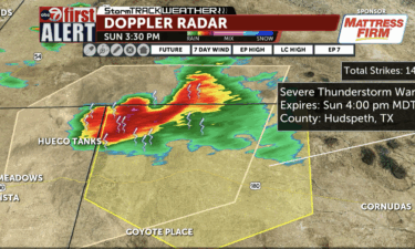
ABC-7 First Alert: Severe Thunderstorm Warning for Hudspeth County until 4 PM, 60 mile per hour winds and penny-sized hail are possible
The National Weather Service in El Paso/Santa Teresa has issued a Severe Thunderstorm Warning for Hudspeth County along US Highway 62/180 until 4 PM this evening. The main hazards are 60 mile per hour winds and penny sized hail! This storm is located 6 miles northeast of Loma Linda and moving to the southeast at
Continue Reading
ABC-7 at 4: TxDOT El Paso urges drivers to stay alert as shifting weather conditions approach
El Paso, TX (KVIA-TV)- Windy dusty weather conditions can impact your drive. Lauren Macias-Cervantes joins us during TxDOT Talk to discuss high winds and keeping your family safe during extreme heat. Closures to keep in mind: I-10 Widening West Closures Phase 2 – Upcoming Closure Saturday, April 11 – Sunday, April 12 (24 Hour Closure) 3 a.m.
Continue Reading
First Alert: Another gusty day in the Borderland, calmer weekend ahead
EL PASO, Texas (KVIA) –We can expect a windy Friday with blowing dust possible across southern New Mexico and far west Texas which could impact some travel plans. Winds are expected to ramp up mid-morning and peak in the mid/late afternoon, with west winds of 20-30 mph in the lowlands and 25-35 mph across surrounding
Continue Reading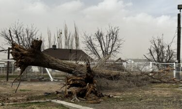
Strong winds in the Borderland knocked down “Doppler” Dave’s trees
ANTHONY, New Mexico (KVIA) — With today’s peak wind gusts reaching 66 mph (106 km/h), numerous downed trees have been reported, including a metal roof ripped off. The front yard of ABC-7’s chief meteorologist, “Doppler” Dave Speelman, bore the brunt of today’s strong winds: two large trees were uprooted, and part of his yard fence
Continue Reading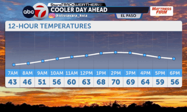
First Alert: Cooler morning, warmer afternoon
EL PASO, Texas (KVIA)– The region will stay dry with above-normal temperatures through early this week and no significant weather impacts. A Pacific weather system arrives midweek, bringing a chance of showers and higher elevation snow on Wednesday and Thursday. Temperatures will remain well above normal until the system moves in. By Thursday, the low-pressure
Continue Reading
Warm start, possible rain chances ahead
EL PASO (Texas) KVIA– In the Borderland a dry pattern with above-normal temps is expected to continue into early next week. However, it’s looking like we can expect a calm day for Saturday. Starting next Wednesday we will begin to see a chance for some light rain, but we will be remaining dry this weekend.
Continue Reading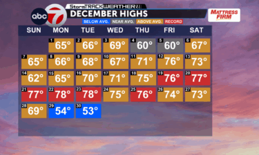
Warmer New Year, cloudy New Year’s Eve
El Paso, TEXAS (KVIA)– A warm spell returns for New Year’s Eve as light rain showers spread across southwest New Mexico overnight into New Year’s Day. Breezy west winds are expected Thursday and Friday, bringing a noticeable uptick in wind across the region. Dry, warmer conditions are anticipated going into this Friday through the early
Continue Reading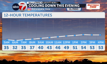
Cool temps today, warming up for New Year’s
EL PASO, Texas (KVIA)– For today, cool temperatures are expected to linger before a rapid warm-up ahead of the New Year. Going into Wednesday night, some scattered shows enter Southwestern New Mexico on New Years Eve, but will dry out near the Rio Grande. Ahead of New Years Eve low hanging clouds and patchy fog
Continue Reading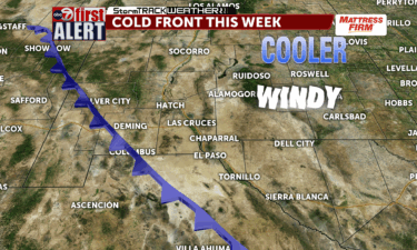
First Alert: Colder temps, grab a jacket this morning!
EL PASO, Texas (KVIA) — A strong cold front arrives to the Borderland, bringing gusty east winds and much cooler temperatures to El Paso and Las Cruces. This, continuing the cooler conditions we saw since Sunday with a backdoor cold front. Scattered wintry precipitation is possible across southern New Mexico and Far West Texas, with
Continue Reading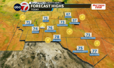
Calm and warm conditions this Monday
EL PASO, Texas (KVIA) — Calm weather will continue for this Monday and Tuesday as an upper ridge shift east, keeping winds light and skies mostly clear for the next two days. Some cloud coverage can be expected as we enter the middle of our work week, with a slight chance of rain going into
Continue Reading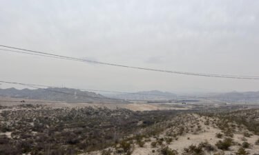
Backdoor cold front leads to cooler temps in the Borderland
EL PASO, Texas (KVIA) — A backdoor cold front is pushing into the region, bringing cooler and near-to-below normal temperatures. Overnight temperatures are expected to drop with wind chills in the 20s east of the Rio Grande. An upper trough moving through the Southern Rockies Monday will bring breezier west winds along with more cloud
Continue Reading
Freeze Warning for portions of Southern NM until tomorrow morning including Deming and Las Cruces
The National Weather Service in El Paso and Santa Teresa has issued a Freeze Warning for portions of Southern NM until tomorrow morning. The warning area includes Deming, Las Cruces, and T-or-C. Cover your sensitive plants and outside pipes. Bring in your pets as well.
Continue Reading
ABC-7 FIRST ALERT: Flash Flood Warning for Northeastern El Paso County until 6:45 PM, including Hueco Tanks and Homestead Meadows
The National Weather Service in El Paso and Santa Teresa has issued the Flash Flood Warning for Northeastern El Paso County which includes Hueco Tanks and Homestead Meadows until 6:45 PM. Up to an inch to an inch and a half of rain has fallen in the warned area which may be causing flash flooding.
Continue Reading ABC-7 FIRST ALERT: Severe Thunderstorm Warning for El Paso, Hudspeth, and Otero Counties until 4 PM
Severe Thunderstorm Warning for El Paso, Hudspeth, and Otero Counties until 4 PM. Main hazards are 60 mile per hour winds and quarter-sized hail. This storm is currently over US Highway 180 and moving northeast.
Continue Reading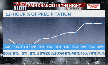
ABC-7 First Alert: Stormy Saturday across the Borderland
Scattered to numerous thunderstorms are expected to develop across the Borderland today. While the greatest impacts will be felt in the higher terrain, storms may drift into the lowlands. Storm chances continue into Sunday with another round of afternoon and evening activity. Highs this weekend will hover in the upper 80s to low 90s, with
Continue Reading Severe Thunderstorm Warning for Dona Ana County including Mesilla until 5:45 PM, 60 mile per hour winds are expected
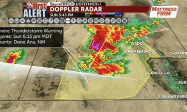
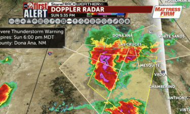
The National Weather Service in El Paso/Santa Teresa has issued a Severe Thunderstorm Warning for Dona Ana County including Mesilla until 5:45 PM. The main hazard is 60 mile per hour winds. This storm is located 13 miles southeast of Akela, moving east parallel to Interstate 10 at 25 miles per hour.
Continue Reading ABC-7 First Alert: Severe Thunderstorm Warning for White Sands Missile Range until 7 PM, winds up to 60 mph and quarter-sized hail are possible
The National Weather Service in El Paso and Santa Teresa has issued a Severe Thunderstorm Warning for White Sands Missile Range until 7 PM, winds up to 60 mph and quarter-sized hail are possible.
Continue Reading ABC-7 First Alert: Severe Thunderstorm Warning for Chaparral, Canutillo, and Santa Teresa until 6:30 PM this evening, 60 mile per hour winds and quarter-sized hail possible
The National Weather Service in El Paso has issued a Severe Thunderstorm Warning for Chaparral, Canutillo, and Santa Teresa until 6:30 PM this evening Main hazards are possibly 60 mile per hour winds and quarter-sized hail.
Continue Reading ABC-7 First Alert: Severe Thunderstorm Warning for Dell City until 6:45 PM, wind speeds up to 60 miles per hour and quarter-sized hail are possible
The National Weather Service in El Paso and Santa Teresa has issued a Severe Thunderstorm Warning for Dell City until 6:45 PM. The main hazards are wind speeds up to 60 miles per hour and quarter-sized hail. This storm is located 9 miles west of Dell City moving east at 15 miles per hour.
Continue Reading ABC-7 First Alert: Severe Thunderstorm Warning for Hudspeth and Otero Counties until 6 PM this evening, 60 mph winds and quarter-sized hail
The National Weather Service in El Paso has issued a Severe Thunderstorm Warning for Hudspeth and Otero Counties until 6 PM this evening. Main hazards are 60 mile per hour winds and quarter-sized hail. This storm is located over Wind Mountain just east of Dell City and north of Cornudas moving east at 20 miles
Continue Reading ABC-7 First Alert: Dust Storm Warning for Central, East, and Northeast El Paso until 7:45 PM
The National Weather Service in El Paso and Santa Teresa has issued a Dust Storm Warning for Central, East, and Northeast El Paso until 7:45 PM. At 6:41 PM, strong outflow boundary from thunderstorms has caused blowing dust over East El Paso. This wall of dust is moving north and west. Less than half of
Continue Reading Flash Flood Warning for Hudspeth County including Fort Hancock until 8:15 PM
The National Weather Service in El Paso/Santa Teresa has issued a Flash Flood Warning for Hudspeth County including Fort Hancock until 8:15 PM.
Continue Reading
Dust Storm Advisory for Otero County until 6:45 PM along US-54
The National Weather Service in El Paso and Santa Teresa has issued a Dust Storm Advisory for West Central Otero County along US Highway 54 between mile markers 21 and 42 until 6:45 PM. At 5:42 PM, a kabob was 7 miles northwest of Orogrande, moving southeast at 20 miles per hour. Hazardous driving conditions
Continue Reading